- About EGYLandscape
- Cartographic resources
- Textual sources
- Key concepts
- Credits and sponsors

A core outcome of the EGYLandscape Project is the historical webGIS presented on this platform, allowing an exploration of rural Egypt in pre-modern times. This webGIS combines textual sources, from the late medieval (13th to 15th centuries) and modern (19th to mid-20th century) periods, with cartographic resources available for the last two centuries to georeference the gathered textual information on a map. The medieval textual sources provide for an exhaustive listing of the basic administrative units and specify their administrative status in their time, thus offering a historical gazetteer of Egypt. Still, these entities considerably evolved over time, with the frequent appearance of new places or administrative units, the disappearance of existing ones, or changes in name or status. The webGIS makes it possible to dive into the geography of rural Egypt over seven centuries by merging, in a single place, all of the information across the consulted historical sources and, therefore, time-periods.
A number of historical and recent cartographic sources, ranging from the 1800s until today, were used to build the EGYLandscape toponyms database. Some of them are presented in the webGIS application, so that they can be compared and/or combined to provide for an insight on the evolution of the Egyptian landscapes over the last two centuries.


Other historical cartographic sources have also been occasionally used to georeferenced data for this webGIS, including The Survey of Egypt topographic maps at 1:25,000, published between 1928 and 1943, and at a scale of 1:100,000, which are most likely compilations of reduced 1:50,000 sheets and were published around 1916.
The webGIS relies upon six main sources of information, either textual or cartographic, offering an exhaustive inventory of the basic administrative units and of the administrative divisions of Egypt across the centuries. They included four medieval textual sources, namely Ibn Mammātī, al-Nābulusī, Ibn Duqmāq, and Ibn al-Ǧīʿān, and two contemporary sources, which are the collection of Survey of Egypt 1:50,000 maps and Muḥammad Ramzī’s geographical dictionary. Other resources were also used on an ad hoc basis to complement the information present in the main sources, all presented below. The initials or names in brackets before each of the following entries refers to the source abbreviation as used across the webGIS.

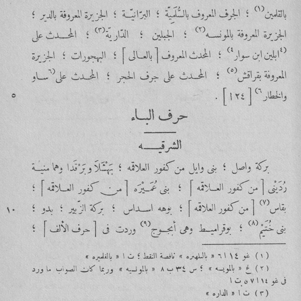
In the webGIS, mentions of Ibn Mammātī [IM - ا م] always refer to the A.S. Atiya edition, Cairo, 1943 of the Kitāb Qawānīn al-dawāwīn.

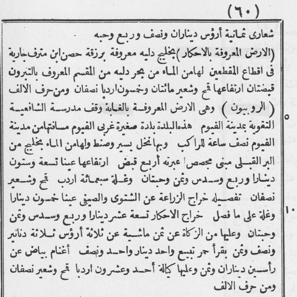
In the webGIS, mentions of Ibn al-Nābulusī [NB - ن ب] always refer to the 1898 edition of the Tārīḫ al-Fayyūm.

In the surviving manuscripts, several pages of this land survey are missing, and much of the information that should have accompanied the place names are left blank. These blanks have been respected by the 1893 Cairo edition of Carl Vollers, to which the webGIS refers when mentioning Ibn Duqmāq [ID - ا د].

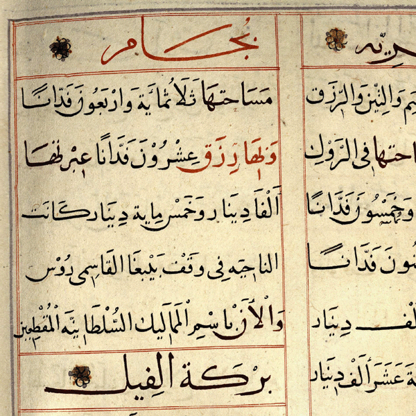
In the webGIS, mentions to Ibn al-Ǧīʿān [IG - ا ج] refer to the Bernard Moritz edition, 1898, of the Tuḥfa. Still, the readings of B. Moritz have often been compared to those of the ms. Bodleian.


The first part of the book is devoted to ‘disappeared villages’, which are those mentioned by the medieval sources but whose agglomeration and name no longer existed. Ramzī took advantage of his position in the civil service to try to discover the location of these ‘disappeared villages’, either on cadastral maps or by asking villagers directly.
While many documents used by Ramzī are no longer available today, notably an impressive set of administrative documents from the governorship of Muḥammad ʿAlī (1805-1848) onwards, his work is a valuable secondary source to explore these, and the on-site investigations he conducted also allowed him to gather precious information on historical Egyptian toponymy.
In the webGIS, mentions to [Ramzī - رمزي] refer to the post-mortem publication of his work, prepared by Aḥmad Rāmī and Aḥmad Luṭfī al-Sayyid.
Other resources have also been occasionally used to complement the information extracted from the six primary sources detailed above. They include:
- The work of Louis Maurice Adolphe Linant de Bellefonds (1798-1883), an engineer in the service of Muḥammad ʿAlī and his successors, who published several maps of Egypt, such as the Hydrographic Chart of Middle Egypt and of the Southern Part of Upper Egypt (1854, completed 1882) and the Hydrographic Chart of Lower Egypt and Part of the Isthmus of Suez (1854, 1855, completed 1882);
- Amédée Boinet’s Dictionnaire géographique de l'Égypte (Cairo, 1899), which is an alphabetical compilation of the 18,141 principal and secondary localities of Egypt according to the 1897 census. It details the name of each place both in Arabic and Latin characters, the number of inhabitants, as well as the status and the position in the administrative division;
-
Heinz Halm’s Ägypten nach den mamlukischen Lehensregistern (Wiesbaden, 2 vols, 1979-1980), which is a gazetteer of late medieval Egypt based on Ibn Mammātī, Ibn Duqmāq, Ibn al-Ǧīʿān and other medieval sources, supplemented by an atlas;
- The Central Agency for the Public Mobilization and Statistics (CAPMAS) and the Centre d'études et de documentation économiques, juridiques et sociales (Cedej) online portal, which provides a cartographic visualization of the results of 14 Egyptian population censuses from 1882 to 2017, available at https://www.cedejcapmas.org/.
The mapping of rural Egypt requires distinguishing between settlements as physical realities and as administrative units. While the maps we used for geolocating toponyms in the webGIS describe different types of settlements (i.e., towns, villages, hamlets or isolated inhabited places), the medieval textual sources were only interested in administrative units (with the exception of al-Nābulusī, who for each unit also describes the physical reality of the settlements it contained). Thus, the EGYLandscape webGIS assumes that a medieval administrative unit corresponds to the village of the same name and area visible on more recent maps, unless positive information indicates that the village has moved. The naming transformations of an administrative unit over the ages, as documented by Ramzī, allows linking the successive names of an administrative unit to its corresponding contemporary villages.
The webGIS attaches a set of standardized information to each place or toponym presented on the map, including a unique identification code, the names relating to each place (including variants), its administrative status, and a kind which briefly describes its physical reality, as detailed below. Beside the identification code, each of these pieces of information is linked to the source (either textual or cartographic) from which it was extracted, thus allowing the user to follow the evolution of the place over time.
- Each toponym is identified by a unique and invariable place identifier. We chose to use the six-digit codes created by CAPMAS for all administrative units in Egypt in the 1996 and 2006 censuses. Derived codes were created for places not included in the CAPMAS lists.
-
In a given source, every place has one or more names. The webGIS distinguishes between the name given first by the source, the alternative name(s) which may also be reported, and simple spelling variants, by storing each of them in separate fields. We conducted standardization and harmonization of names, both for their Arabic names (provided by all sources) and their transliteration:
In Arabic, we decided to always write the tā’ marbūṭa as [ـة] and the final ī/y as [ـي], the initial hamza is never written, nor is the hamza carried by an alif within a word, but the hamza carried by a wāw or a yā’ within a word is kept.
The transliteration of toponyms into Latin characters follows the IFAO standards. We used the classical forms of common Arabic terms found in double toponyms (such as Dayr, Kawm, Minša’a, etc. or Awlād and Banī). However, the dialectal pronunciation variants of these terms was left to the discretion of the editors of the records for the webGIS database entry. In all cases, only three short and three long vowels were kept: a, i, u, and ā, ī, ū. For the medieval sources, which do not record short vowels (except for the ms. Bodleian, Huntington 2 of Ibn al-Ǧīʿān), the reading proposed by Heinz Halm, based on modern sources, was most often adopted, and we sometimes offered our own reading.
While the Survey’s maps transcribe a vernacular pronunciation in Latin characters, which is valuable in this respect, we have most often rendered e as i, o as u, ô as ū, and ei as ay. The maps’ vocalization of toponyms of obviously Arabic origin were sometimes standardized to their classical form, but sometimes maintained as were in order to reflect the pronunciations in use a century ago.
We followed, as much as possible, the information given by Muḥammad Ramzī, who most often provides the short vowels in Arabic. Note that he has often indicated by a special sign, ^, the vernacular pronunciation of the diphthong ay, which we have transcribed ay. Where Ramzī does not provide the short vowels, we relied on Boinet and the Survey map, which give the place names in both Arabic (vocalized by Boinet, not by the Survey maps) and Latin characters. The frequent discrepancies between Boinet, the Survey maps, and Ramzī are due to lapses in the vernacular pronunciation or in its understanding by officials used to the Cairo language. -
By the end of the Middle Ages, all settlements in rural Egypt were part of administrative units, thus bearing an administrative status. The vocabulary designating these units varies according to the sources: nāḥiya, qarya, balda are the most frequent terms. We have chosen the term Nāhiya [ناحية] as a generic name for the basic administrative unit (called “Local Unit” in the webGIS). These are the record entries in al-Nābulusī, Ibn Duqmāq and Ibn al-Ǧīʿān.
As a general rule, a nāḥiya corresponds to the village that bears its name. Still, some nāḥiya may bear a double or even triple name, corresponding to two or three settlements, either surviving or extinct, at the time at which the registry was compiled by a given source. Some units also included dependent settlements, for which we are less well informed. The webGIS database designates their status as a "dependency" [تابع]. In these cases, the name of the locality differs from that of the Local Unit to which it was attached. Likewise, there are nāḥiya without villages, whose inhabitants are agglomerated in the village of another neighbouring Local Unit.
In contemporary times, secondary dependencies or agglomerations are present, below the village level and bearing the same name as the nāḥiya in which they are located, notably the naǧʿ that result from the sedentarization of the Bedouin or the ʿizba which is an agricultural estate. We have noted these dependencies when, at one time or another, they had the status of an administrative unit.
Every nāḥiya was part of a province, a higher level administrative division of Egypt. Its organization evolved over time, with some appearing or disappearing. The terms designating the provinces (ʿamal, iqlīm, wilāya, mudīriyya) also changed over the periods and the consulted sources, but we have retained the generic name of province [إقليم] across the webGIS database. In contemporary times, districts (markaz) were created as an intermediate administrative level. Every rural nāḥiya now belongs to a district and a province. - On the webGIS, the kind refers to the type of settlement in the corresponding source. For medieval sources we have retained only three categories: madīna for provincial capitals, village for villages named after the basic administrative units, and hamlet for dependent settlements. In the twentieth century (Survey and Ramzī maps), the variety of settlement types flourishes. There are ʿizba (agricultural estate), tall and kawm (hill, frequently archeological), archeological site, monastery, etc.
Citing the platform and its dataset:
This work is licensed under a Creative Commons CC BY License, which allows users to distribute, remix, adapt, and build upon the material of this webGIS in any medium or format, so long as attribution is given to its creator.
Please give credit to any image or data used from this platform with the recommended citation:
EGYLandscape webGIS. [Year accessed]. Version [Date Accessed]. Available at: [URL to the platform].
Credits and participation:
Historical data acquisition: G. Alleaume, M. Ghiglia, N. Michel.
Geographic data production: G. Alleaume, F. Dubertret, M. Ghiglia, H. Rakrouki.
Data curation: G. Alleaume, F. Dubertret, M. Ghiglia, N. Michel.
Platform conceptualization and software development (based on open-source libraries): F. Dubertret.
Website/platform administration: V.Bayle, F.Dubertret.
Project administration: N. Michel.
Acknowledgment and Sponsors:
We would like to express our gratitude to Eric Denis and François Moriconi-Ebrard (CEDEJ) for the valuable datasets they shared with us on Egypt’s administrative organization and censuses, which served as a basis for organizing the data collection for this webGIS. Vincent Bayle’s (MMSH) help was also critical in setting-up the server for this platform, as well as taking-on its administration for future maintenance. Last but not least, Aurélien Reys helped in drafting the first ideas which later became this webGIS platform.
Date conversions between the different calendars were done using the tool developed by Johannes Thomann, University of Zürich, available here.
The EGYLandscape project was jointly funded by the French Agence Nationale de la Recherche and the German Deutsche Forschungsgemeinschaft. The webGIS platform is hosted on the Huma-Num, the French research infrastructure for Literature, Humanities, Social Sciences and Digital Humanities.


